Thursday 5 February 2015

Great Crag, 4 Deer Fences, 3 Tarns, 2 Synges & 1 Failed Shortcut

Its always when the distance back home is more than the distance to the hill when you realise that you've forgotten something! Today it was when I pulled into Kettlewell car park to take a quick shot of Derwentwater - fortunately I keep a little point and click in the glove box so all was not lost, just a shame it had a bit of dirt on the mens! A short time later surprisingly I was the only car in Stonethwaite's small car park, booted for Great Crag and its two neighbouring summits Knotts & High Crag.

Skiddaw and an icy Derwentwater...

the steep pull through the woods over, the view to Honister Pass...

sunrise over Greenup Edge...

a quick heather bash and an unexpected wall topped with a deer fence, possibly Knotts high point, well its got a cairn so it will do (I don't suffer from summit OCD), Synge #1...

Great Crag, not far away...

its summit, Watendlath Tarn & High Seat...

a frozen Dock Tarn, saw a few deer but they beyond the little cameras zoom...

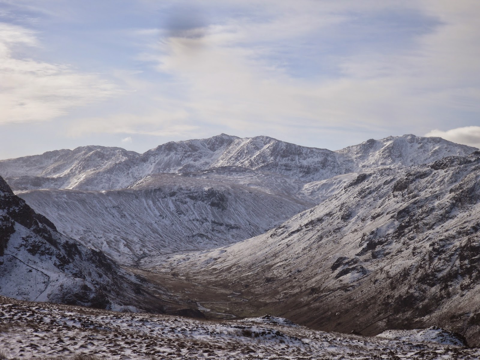
another deer fence crossing, and High Crag (synge #2) gave a splendid view down my favourite valley, Langstrath...

I started more deer, but they where still out of range and blended into the heather...

with no wind they didn't seem startled but maintained a safe distance, so I approached and herded them up to the skyline, finally got them...

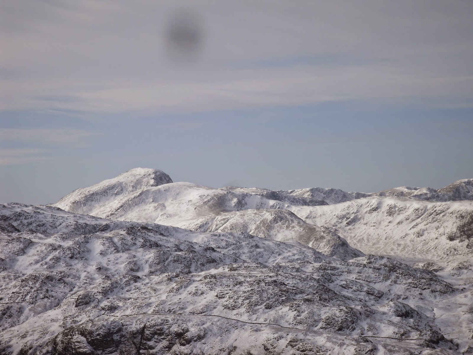
Bow Fell, note the dirt on the lens :(...

view down to Bass...

Great Gable...

Fleetwith Pike and the Buttermere Fells...

Bowfell again...

Ullscarf...

the dog...

descending to Standing Crag...

icy descent...

looking back to Standing Crag...

a frozen Blea Tarn...

I was following the bridle way which picked up the High Tove path, but noticed a couple sets of footprints heading direct to Watendlath, suspecting a sneaky unknown route I followed them...

ice on Bleatarn Gill,

the gill narrowed & steepened and I had to cross a steep lethal frozen beck, shortly after crossing this was my 3rd wall topped with a fence and no sign of a gate, the footprints climbed this at the same point I selected to cross...

I disturbed another smaller herd of at this deer fence, the fourth, which also need crossed, no sign of a gate, frozen Watendlath Tarn...

never seen this nice packhorse bridge before...

climbing the bridleway to Rosthwaite...

the bridleway's summit...

green lane to Stonethwaite...


Moral of the day, don't follow footprints they don't know a sneaky shortcut but in fact are lost...

Friday 30 January 2015

Snowy Fellbarrow & Low Fell - Hunting for Whin Fell

Its been a while since my last blog, one or two things got in the way and by the time things had returned to normal I was out of the habit of posting! As the months rolled by I vowed to resume 'normal' posting as a New Year resolution; ok I know its a bit late but its still January and 2015!!

The forecast for today was for a 90% chance of cloud free summits and upland gales - in one hand it was perfect but in the other the fun would be taken away. The first thing that hit me when I started scraping the ice off the windscreen wasn't the expected gale, in fact it was still? And as I headed up the road everything was shrouded in cloud - I've always been told if there is no wind then the clouds will build up (this may well be inaccurate?). I'd set off with a loose plan of either Grasmoor or Red Pike (Buttermere) but as the signs for Lorton approached it was obvious I wouldn't get a view - even Low Fell & Fellbarrow where in cloud. As the lowest hills these would be the first to clear and the Synge top of Whin Fell was still on my to-do list, the car was quickly parked in the ample space next to the telephone box & bottle banks.

Whin Rigg is awkwardly situated at the end of the Low Fell - Fellbarrow ridge, the easiest approach seemed to be over the fell road (this was a regular bike route from home when I was about 17!)...